Destination guide
Petauke, Zambia
The Nsenga town at the midpoint of the Great East Road, and the start of two hard 4×4 routes.
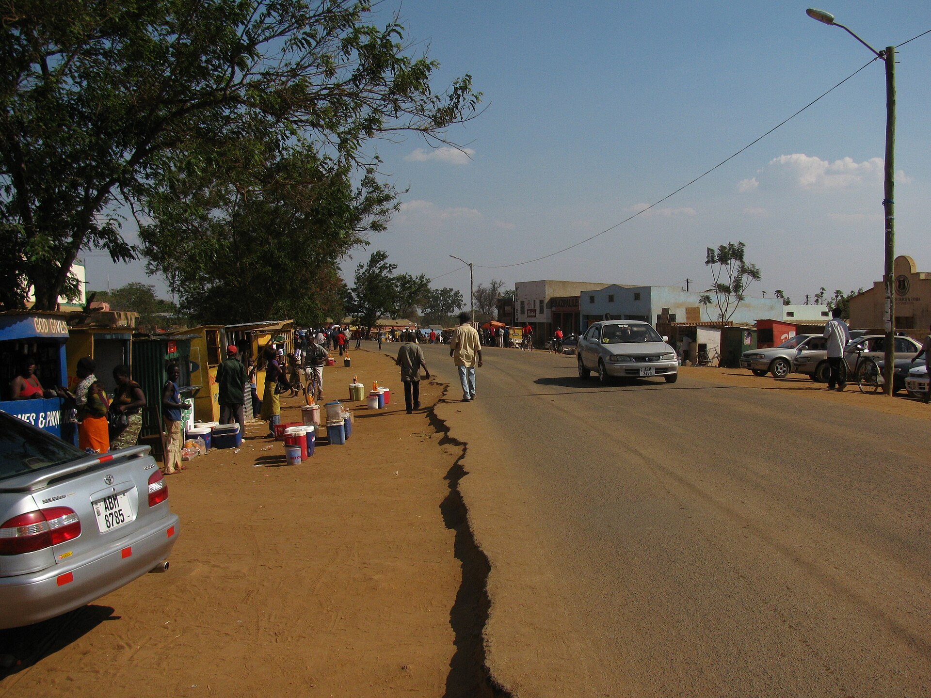
Photograph by Scoterican, 23 September 2011, via Wikimedia Commons. Licensed CC BY-SA 3.0.
Petauke sits on the plateau above the Luangwa escarpment, roughly 380 to 400 kilometres from Lusaka and 167 short of Chipata. It is the Nsenga cultural centre and an agro-industrial town of ginneries and mills. For most travellers it is the standard overnight break on the drive to South Luangwa or Malawi.
On this page
Where Petauke is
One correction worth making at the outset: Petauke is above the Luangwa escarpment, not below it. The Great East Road runs for most of its length on watersheds at around 1,000 metres, while the Luangwa River at the bridge is at 390 metres. The valley lies below Petauke to the north and west.
The T4 bypasses the town to the south; the D138 provides access to the centre. You have to turn off deliberately. The town itself has about 14,000 residents against a district population of roughly 259,385 at the 2022 census.
Why stop here
- Senior Chief Kalindawalo’s palace at Merwe, about ten kilometres from the Boma — the seat of the Nsenga paramountcy and the reason Petauke functions as the Nsenga cultural centre.
- The Tuwimba ceremony, held in October at Petauke under Senior Chief Kalindawalo.
- The Petauke shortcut into South Luangwa. A 4×4 track leaving the Great East Road at Petauke and running north alongside the Luangwa River to Mfuwe. Strong 4×4 only, and only well into the dry season.
- The remote route towards the Lower Zambezi side — a dry-season-only gravel and two-spoor run across the Mushika and other dry rivers, roughly seven and a half hours in good conditions.
- Agro-industrial town infrastructure you can actually see: cotton ginneries, maize mills, cooking-oil refiners, a brewery and saw-mills, processing the surrounding maize, cotton, sunflower, groundnut and soya.
What to understand before you go
- It is a farming and processing town, not a safari town, despite sitting at the mouth of two Luangwa routes.
- The T4 bypasses the centre. If you do not take the D138 turn-off you will drive straight past.
- Nsenga is the language here, and it is a distinct language rather than a dialect of Chewa. Petauke and Nyimba are the two Nsenga districts.
- It is the natural halfway break on Lusaka–Chipata, which is its main function in a Zambia route.
Getting there
From Lusaka, east on the T4: Lusaka to Chongwe 30 kilometres, Chongwe to Rufunsa 115, Rufunsa to the Luangwa Bridge 70, then 165 kilometres through Nyimba to the Petauke bypass. About 380 kilometres to the bypass; Petauke is described as 400 kilometres east of Lusaka. Allow roughly five to six hours.
- From Chipata: about 167 kilometres west — Chipata to Katete 80, Katete to Petauke 87 — roughly two to two and a half hours.
- Rail: none. A 2015 proposal to link Chipata through Petauke to Serenje has not been built.
- Air: an airstrip near the town is recorded as operational but rarely used. No scheduled flights.
- Road surface: the T4 has at times deteriorated considerably, and the 1968 Luangwa Bridge has been awaiting a funded replacement since 2022.
Getting around
The town centre is compact and walkable — the shopping complex, pharmacies and fuel stations are all in the core. Long-distance buses on the Lusaka–Chipata run stop at Petauke. For anything off the tarmac — Merwe, the Luangwa valley tracks — you need your own high-clearance 4×4; those routes are not served by public transport.
When to go
Petauke’s rainfall is sharply seasonal: January 247 millimetres, February 229, December 208, against 0.1 to 0.5 millimetres in June, July, August and September. The annual total is 967 millimetres. June and July are the coolest months with mean lows around 11°C; September and October are the hottest, with mean daily maxima of 28.0 and 29.9°C.
The tarred T4 is passable year-round, but every unsurfaced route out of Petauke is dry-season only. The Lower Zambezi link becomes impassable every wet season, and the Mfuwe valley shortcut should only be attempted well into the dry. The Tuwimba ceremony falls in October — end of dry season, hottest month.
How long to give it
A one-night stop. Petauke sits at the practical midpoint of the Lusaka–Chipata–South Luangwa drive, which makes it the standard overnight break on a self-drive run. It becomes a base only for a 4×4 expedition using the valley track or the route towards the Lower Zambezi — both dry-season undertakings measured in days rather than hours.
Where to stay
Most stays here are one night on a long drive. Every property below is filed here on verified coordinates inside the approved Petauke catchment, and each listing is our own write-up rather than an operator’s description.
Nearby and onward
- Katete — 87 kilometres east on the T4, where the T6 branches towards Mozambique, with St Francis’ Hospital north of the town.
- Chipata — about 167 kilometres east. Eastern Province capital and the gateway for South Luangwa; the Mwami border with Malawi is 18 kilometres further.
- Mfuwe and South Luangwa National Park — 123 kilometres from Chipata on tarmac, or the direct 4×4 valley track from Petauke. 9,050 square kilometres, 60-plus mammal and 400-plus bird species, and the birthplace of the walking safari.
- Luangwa Bridge — 165 kilometres west, the Great East Road’s only major river crossing.
- Luambe National Park — 254 square kilometres in the same valley on the east bank. Cookson’s wildebeest, Thornicroft’s giraffe and roan. Dry season only.
Practical notes
- Fuel: two filling stations in town. Fill here — the next comparable stops are Nyimba to the west and Katete or Sinda to the east.
- Banking: a bank branch with ATM, plus a second branch.
- Mobile signal: recorded as good in town, with all three networks present. Coverage on the valley tracks is not established.
- Health: Petauke District Hospital in town, plus Minga and Nyanje Mission Hospitals in the district. Higher-level care means Chipata.
- Safety: the two real hazards are the T4 itself — heavy truck traffic and sections of deteriorated surface — and committing to the unsurfaced valley routes, which are best driven with two vehicles because help is a long way away.
Common questions
Does the Great East Road go through Petauke?
No. The T4 bypasses the town to the south; the D138 links the bypass to the centre.
Can I drive from Petauke to South Luangwa without going via Chipata?
There is a 4×4 shortcut running north alongside the Luangwa River to Mfuwe, but it needs a strong 4×4 and should only be attempted well into the dry season. The reliable route is Petauke to Chipata, then Mfuwe.
What language is spoken?
Nsenga — a distinct language, not a dialect of Chewa.
When is Petauke hottest and wettest?
Hottest in September and October; wettest in January and February. July and August are effectively rainless.
Sources
Every factual claim on this page was checked against the sources below on 18 September 2026. Where a fact could not be established from a source we can cite, we say so on the page rather than fill the gap.
- en.wikipedia.org/wiki/Petauke
- en.wikipedia.org/wiki/Petauke_District
- en.wikipedia.org/wiki/Great_East_Road_(Zambia)
- en.wikipedia.org/wiki/Luangwa_Bridge
- en.wikipedia.org/wiki/Nsenga_people
- www.zambiatourism.com/destinations/national-parks/south-luangwa-national-park/
- en.wikipedia.org/wiki/Zambian_traditional_ceremonies
Planning the wider trip? Start with our Zambia accommodation guide, or the Luangwa Valley region page.
Tours and activities around Petauke, Zambia
Operators sell most Zambian day trips, safaris and transfers out of the bigger bases rather than from Petauke, Zambia itself, so we do not pretend there is a local booking market here. The full list of experiences we carry is organised by activity, and several of them run into this part of the country.